Ejamaat website now sports a new look.....
more suble colors and web2.0 layout but still old fashioned header fonts....


 E-Jamaat website revamped
 Zoho Projects Updates
Zoho Projects underwent an update just now and the below features are now available.
Multiple Admins : Till now, Zoho Projects followed the single admin concept. But from now on, there can be multiple admins. The one who created the Zoho Projects account is assigned the super-admin / portal owner role. And he/she can designate other members as Administrators. These administrators have all the previleges as the portal owner except upgrading/downgrading the Zoho Projects account & changing the credit card details.
Task-Documents and Task-Forums Mapping : Along with adding Notes to a task (which is useful for knowing a task’s status etc), documents uploaded to Zoho Projects and discussion forums created for a project can now be associated with tasks. Multiple documents/forums can be associated with a task and a forum/document can be associated with any number of tasks.
Managers can add Clients : Project members in Manager role can now add (external) client members to the projects they manage. This gives a Manager fuller control over the project(s) he/she manages.
Separate iCal link for Google Calendar : Google Calendar follows the VEVENT component as againt the VTODO component that needs to be followed for tasks/tasklists/milestones. To support GCal, Zoho Projects now has a separate GCal link. Clicking on the links, you can download an .ics file which you can import into your iCalendar / Google Calendar.
Beijng Olympics - Google Mapified
Google Maps now has detailed map tiles for the major cities in China.
If you want to have a good look around the stadiums built for the Beijing Olympics 2008 you should visit EarthSwoop's Beijing Olympics collection of 3d buildings. EarthSwoop use the Google Earth Browser plug-in to show 3d buildings built for Google Earth.
I also received an e-mail today from noicon.biz to say that Google Maps in Japan has been updated to show the names of some houses and commercial locations. You can see this change in the screen-shot below where some buildings seem to have been tagged with little red dots. 
Facebook Profile Page Beta Is Now Live
 Google Earth Imagery Update Quiz
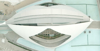
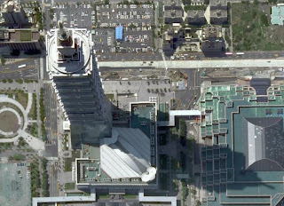
Today I'm happy to announce that we've just finished pushing out an imagery update for all you Google Earth fans out there. As usual, I'll drop a few hints at where these updates might be, and tomorrow I'll post the complete list of updates.
1) Founded in 1608, this former British possession has a decidedly French flair.
2) Once the seat of great political power, this red fortress is now a major tourist attraction.
3) Now a UNESCO World Heritage Site, this city was lost to the world for 1700 years.

 Gmail - Suggested Contacts
Google has finally realized that it's a bad idea to automatically add to the list of Gmail contacts all the people you've sent an email. An updated version of Gmail's contact manager has a separate section for the people you've emailed: "suggested contacts".
"My Contacts is a place to import, store and view all of the contact information that's important to you. You can also create your own groups of contacts to easily email many people at once. We add people you've emailed to Suggested Contacts. You can move contacts from Suggested Contacts into My Contacts at any time."
There's an option to automatically move suggested contacts into My Contacts if you frequently email them, but the previous behavior doesn't seem to be an option. 
I don't have this new version of the contact manager, so if you notice other changes, post them in the comments.
GEB announces July 2008 Imagery Update for Google Earth
I've started getting reports of new imagery available in Google Earth today! The update is occurring as I write this because not everyone is seeing the new images yet, but it will probably be fully deployed within a few hours. Here are a few places I've confirmed (I will update this list as people tell me about other places - leave comments below please):
[UPDATED 1130, 1143, 1150, 1410, 2220 EDT]
Google Earth 4.3 (beta) Update Available - Version 4.3.7284.3916
There's a new version of Google Earth 4.3 (beta) available. This release does not appear to introduce new features, but it does address a number of issues some of you have encountered with GE 4.3 which was released in April. Since Google has had a couple of months, I'm expecting this version to be a more stable version to use. I'm still waiting for an official report and release notes, and will add the details here when they are available. See the official release notes for this update below. There's a lot of fixes to a variety of problems - many that only applied to certain OSes, or system configurations. Head on over to the official Google Earth Download page to get the latest (the "Check for Update" currently won't find this new release.)
See the initial review of Google Earth 4.3 for reasons why you should get the new version if you are still running an older version of Google Earth. Or, check out the GEB video demo of GE 4.3:
Google Spreadsheets - Form feature Updates
Being a rugular user of Google Docs and Spreadsheets, I have recently noticed quite a few improvements in Google Spreadsheet's Form feature.


 Google's Blogger Updates
It's raining with features in the experimental version of Blogger, available at http://draft.blogger.com. To try these new features, it's a good idea to visit Draft Blogger and temporarily enable "Make Blogger in Draft my default dashboard" at the top of the page.
Probably the most important new feature is the inline commenting system, that lets you post comments without opening a new page. This year, I tried using a pop-up window for the comment form, but it's still inconvenient to post comments. The new option, which can be added in the Draft Blogger by going to Settings > Comments > Comment Form Placement, uses an iframe to display a textarea and a list of authentication options:
I added the inline comment form to the template, so you can try it. For now, you can't preview the comment before posting it and I haven't figured out how to add the option to delete your comment.
Another extremely useful new feature lets you import and export your posts and comments. "Now you can export all of your posts and comments into a single, Atom-formatted XML file for easy backup. You can then import the posts back into Blogger, either into an existing blog or into a new one." The option is available in the Draft Blogger by going to Settings > Basic. Please note that the exported XML file can be quite large: for example, this blog's entire archive has 10.2 MB.
Blogger has a new post editor that borrows a lot of new tricks from Google Page Creator. You can move the images inside a post and dynamically choose between different sizes of the image. The new editor is smart enough to no longer replace newlines with
tags when you add tables, lists, styles, scripts and objects. There's also an improved preview option that uses your template to style your content. Unfortunately, the new editor lacks many features currently available: auto-save, spell checking, video upload and the toolbar for editing HTML.
Blogs that use the new layouts can add star ratings to get feedback from readers, but I'm not sure if this is a useful feature. There's also an option that integrates Blogger with Google Webmaster Central: you can automatically add all your Blogger blogs with a single click.
This is one of the biggest updates to Blogger and many of the new features are long overdue. If everything goes well, all these features will soon be available in the standard Blogger interface.
Zoho Show Updates
As you may know, there were recent updates to Zoho Sheet and Zoho Writer. Continuing on the series of updates, the below new functionalities in Zoho Show are now available.
1. Export to PPT, PPS, PDF, ODP : Zoho Show has long had the ‘Export as HTML’ option. Now we have added the much needed ppt, pps, pdf & odp file export options as well. After opening a presentation, click on the Export button. You will find the new options
2. Languages support : 9 new languages. In addition to English, the Zoho Show UI can now be set to one of these languages too : Chinese, Danish, Dutch, French, German, Italian, Japanese, Portuguese (Brazil), Portuguese (Europe), Spanish & Swedish
3. Personal Groups and Contacts support : Click on Share. You will see the Add Contacts, Add Groups option.
Group the email addresses of your contacts (work, family etc). Useful when repeatedly sharing presentations (need not type all the email addresses again). Also, all your Zoho contacts - the ones who you have shared documents with, from your Zoho Mail account etc - get listed while you share a presentation (auto-suggest feature which will help you in easily picking up who to share a presentation with.
4. Undo/Redo : You can now undo/redo upto 50 actions. You can see the new undo & redo buttons in the toolbar
5. Picasa Integration : Click on the Insert Image icon. You can see Picasa listed along with Flickr (which was already there). You can insert public pictures from your Picasa account
6. Remote Presentation - UI enhancements : Click on Remote -> Make Remote. Try making a remote presentation. You will see a chat tab to the right. The Notes tab is open (for the presenter alone) below the slide area. And the slide area size can be adjusted (to accomodate notes)
Customize Zoho Projects
As a versatile project management tool, Zoho Projects offers quite a few options that can be customized. Let’s see some of those here. All these options are accessible by clicking on the Settings link at the top-right (and the tabs there - General Settings, Company Settings)
Utilize the above options to get the maximum out of Zoho Projects.
Zoho Sheet Updates
After our Macros and Pivot Tables update in April, we did couple of updates in Zoho Sheet and here are the highlights.
New Theme - Mint Blue
The first thing you are likely to notice is that Zoho Sheet now sports a light blue theme as in the screenshot below (click on image to enlarge). This blue theme has been made as the default theme. You can select the various themes from the Themes menu at the top.

Public Spreadsheet URLs
We have made the URL of your public spreadsheets much shorter and much more readable. For example: http://sheet.zoho.com/public/sripathyramesh/crm-calculator. Your existing public URLs and embedded spreadsheets will continue to work as well.
We have also provided a page for an user’s public spreadsheets. For example http://sheet.zoho.com/public/dreamisle/ lists the public spreadsheets of dreamisle and you can find some nice spreadsheet puzzles there. There is also an RSS feed provided for an user’s public spreadsheets.
You can now export a public spreadsheet by appending .filetype at the end of the URL. For example: http://sheet.zoho.com/public/username/documentname.xls will export the spreadsheet to XLS format. Supported extensions include xls, sxc, csv, html and pdf.
We also show the number of views of a public spreadsheet. They are available at the top of a public spreadsheet. We have been tracking views since the last 3 months.
Charting Enhancements:
We have done some enhancements to our charting engine.
- You can draw charts on a different sheet in the same workbook.
- Charts on discontiguous data ranges are supported as well.
- The Y-Axis scale of charts will automatically be adjusted depending on the values.
- We have also changed the default chart colors as seen in the above screenshot.
More enhancements in Charting on the way.
Other Enhancements:
Read our What’s New page for more detailed information.
Terrain Representation Updates in Google Maps
Mehmet K. noticed an update of the terrain layer from Google Maps, a feature that lets you view physical features, such as mountains and vegetation, with elevation shading.
The fairly recent "terrain" feature in Google Maps now plots contours as well as hill shading. The only problem that I can see is that the contours are in feet in the UK whereas feet are only really used in the States. Even in the UK where we still use miles for our roads, looking at familiar hill heights in feet is very off putting. When I looked at other countries (Kenya) the heights there were in meters.
 Google Earth plug-in to be Updated This week
Firefox 3 is set to be released tomorrow, and Mozilla is hoping for five million downloads. My concerns had been two-fold: Firefox 3 breaks the Google Toolbar and the Google Earth Plug-in. However, the toolbar has been updated today to work with FF3, but what about the plug-in?
There has been no word from Google about a possible update, so maybe it’s not coming. However, with Firefox 3 getting rave reviews, I would expect that the adoption rate will be quite high. I would hate to see the plug-in take a bit step back by suddenly not working on millions of computers…
Google Earth plug-in to be Updated This week
Firefox 3 is set to be released tomorrow, and Mozilla is hoping for five million downloads. My concerns had been two-fold: Firefox 3 breaks the Google Toolbar and the Google Earth Plug-in. However, the toolbar has been updated today to work with FF3, but what about the plug-in?
There has been no word from Google about a possible update, so maybe it’s not coming. However, with Firefox 3 getting rave reviews, I would expect that the adoption rate will be quite high. I would hate to see the plug-in take a bit step back by suddenly not working on millions of computers…
Firefox 3 gets Google Gears
If you already use Firefox 3 (download links), you noticed that Google Gears was one of the many extensions developed by Google that didn't support the next version of Firefox (Google Toolbar and Google Browser Sync are other notable examples).
Google Gears 0.3, released last week, added support for Firefox 3 and extended the desktop integration by allowing applications to create shortcuts on the desktop or in the start menu. Google Docs is one of the applications that takes advantage of this feature and shows the following dialog when you enable Gears.
Obviously, it's not very difficult to create a desktop shortcut for a web page and you don't need Gears for this, but the small desktop integration is a nice touch. Google Toolbar for Firefox goes further and it lets you open documents from your computer in Google Docs, but the extension is not yet compatible with Firefox 3.
Mozilla Prism is another project that brings web applications closer to the desktop. "Prism, previously known as WebRunner, is a product in development which integrates web applications with the desktop, allowing web applications to be launched from the desktop and configured independently of the default web browser."
Update: CNet mentions two new features from the next version of Gears: the blob and geolocation. "The blob module lets a Web browser handle a large chunk of data in pieces, for example, uploading a large video bit by bit to better protect against unreliable network connections. The geolocation module gives browsers abilities to use data about where exactly a person using the Web is located, but Google hasn't worked out exactly how to handle the privacy implications of that work."
More Unannounced 3D Buildings in Google Earth June 2008 Update
 The 3D Buildings layer update on June 4th, which included the huge collection for Disney World in 3D, included many other 3D Buildings for cities around the world. Already mentioned were those in San Diego and Chicago. But, Google hasn't announced that there are some other significant 3D building model additions in other cities like:
Dallas - Many of the buildings in downtown Dallas, Texas area have been modeled
Sydney - A bunch of new notable skyscrapers in Sydney have been added, and the Sydney Opera House has returned (the 3D model had disappeared in Google Earth a couple of months ago). And Crocodile Man is back.
Tokyo - Many new 3D building models are scattered about this huge city in Japan.
Christchurch - In 2007 many of the buildings in Christchurch were added. Now there are even more and they've been converted to the loading format supported by GE 4.3.
There are hundreds of cities with at least a few 3D buildings in Google Earth. But, there are now dozens of cities with nearly complete 3D renderings of at least the major skyscrapers. I'm sure there were many more cities who had significant new 3D buildings added on June 4th. Feel free to drop a comment here if you know of any other substantial additions (more than a few scattered buildings). No comment at this time comparing Google's approach to the way Microsoft's Virtual Earth team is doing things (but, I plan to). But, right now I like to just look at both when I want to see a city in 3D - after all, they're both free to use and view!
Happy Birthday Street View - keep growing
To celebrate Street View's one year birthday, I am very happy to announce we are bringing Street View to 37 (you heard me - 37!) new areas and we have expanded coverage in 15 of our existing areas. All in all, this effectively doubles our coverage. The new cities include:
 And finally, in the spirit of getting better with age, the face blurring technology we began testing in Manhattan has been deployed for all of our imagery. Remember that all these new Street View images are simultaneously available in Google Earth and through Google Maps API.
Google Updates Street View Imagery in 37 New Areas of US
And finally, in the spirit of getting better with age, the face blurring technology we began testing in Manhattan has been deployed for all of our imagery. Remember that all these new Street View images are simultaneously available in Google Earth and through Google Maps API.
Google Updates Street View Imagery in 37 New Areas of US
In celebration of Street View's first year of public availability, Google has made a major update to the Street View imagery. Unfortunately, none of the imagery is outside the US yet (despite the many sightings of Street View cars taking imagery in Europe). But, this update not only includes the many new cities in over a dozen states, but also updated and expanded coverage in many of the cities which already had Street View imagery. In particular, Google says more of the imagery now has more spherical panoramas (so you can look up and down in addition to 360 degree panoramas). And, they've worked on improving resolution and picture quality. Also, all the imagery has been processed with their new face-blurring technology to address some privacy concerns. Not only that, but the entire update is also available in the Google Earth Street View layer. Just to whet your appetite, here's one of the new cities:
Read the full details on the new and expanded coverage over at Google's LatLong Blog. And, to see interesting sights found in Street View, or to share interesting things you find in the new imagery, try out Google Earth Hack's new Street View sightings database.
P.S. My apologies for the small number of posts the last few days. Had a bit of family crisis when my nephew Jason was involved in a traffic accident. Thankfully, he is miraculously all right now, and should completely mend in a few weeks. The other good news is that I got to do some flying in a Cessna between several states during the last few days.

 Posts
All Comments
Posts
All Comments


